expedia
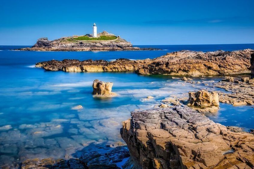
Godrevy lighthouse
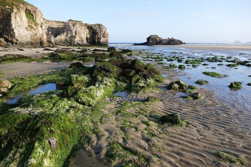
Perranporth, Cornwall
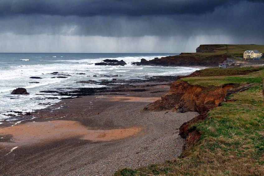
Crooklets Beach, Bude

South West Coast Path Walking North Cornwall Coastline (13 days, 12 nights)

By Compass Holidays
Free cancellation available
Price is AU$2,323 per adult
Features
  • Free cancellation available
  • 13d
  • Mobile voucher
  • Instant confirmation
  • Multiple languages

Activity location

  • Bude
    • Bude, United Kingdom, United Kingdom

Meeting/Redemption Point

  • Bude
    • EX23, Bude, England, United Kingdom

Check availability


South West Coast Path Walking North Cornwall Coastline (13 days, 12 nights)
  • Activity duration is 13 days13d13d
  • English
Starting time: 9:00 am
Price details
AU$2,322.87 x 1 AdultAU$2,322.87

Total
Price is AU$2,322.87

Know before you book

  • Not recommended for travellers with spinal injuries
  • Not recommended for travellers with poor cardiovascular health
  • Not recommended for pregnant travellers
  • Service animals allowed
  • Public transport options are available nearby
  • Travellers should have at least a moderate level of physical fitness

What you can expect

The South West Coast Path is one of the UK’s National Trail footpaths, running 630 miles from Minehead in Somerset, round the South West tip of England to Bournemouth in Dorset. This itinerary focusses on the North Cornwall Coastline, starting in Bude and continuing round the tip of Land’s End to finish in Penzance.

What's included?
Breakfast included, other meals excluded
Luggage Transfers between accommodation providers
Fully comprehensive tour pack with maps, available in English, German, French and Italian as standard. (Other languages available on request)
Access to a smartphone digital app which offers GPS tracking for the routes (downloaded prior to save on data costs)
Access to a 24/7 helpline in case of any emergencies

Exclusions
Entry or admission fee
Landing & facility fees
Individual travel to the UK
Lunch & Dinner
Travel Taxes
Entry fees to attractions

Please note
Passport required
Passport needed if travelling to UK from other countries

Activity itinerary

Day 1: Arrive Bude
  • 1 stop
  • Meals: Not included
  • Accommodation: Overnight in local B&B
Bude
  • 2h
Bude was a little port which enjoyed its trading heyday in the late 19th century, served by a canal and railway for transport of goods, going on to become a popular English seaside resort. Bude attracts visitors each year to enjoy its spotless beaches, fantastic coastline, golf courses and deep sea fishing experiences.
Day 2: Bude to Boscastle
  • 1 stop
  • Meals: breakfast
  • Accommodation: Overnight in local B&B
Boscastle
  • 2h
Leaving the beautiful beaches of Bude behind, the first part of today’s walk is classified as easy, all the way to Widemouth Bay. The path starts the day off grassy before giving way to a track lined with gorse bushes, hugging the cliff past Compass Point Tower, Phillip’s Point, Higher Longbeak and Lower Longbeak, before reaching Widemouth Sands. Here, you will descend into the beautiful bay to stick on the paths, before rising back onto the grassy slope at Black Rock. Continuing between a mix of grassland, gorse shrubbery and small woodland, today’s route is famous for its views, as well as the sites of geological interest like Crackington Haven where the rock strata are clearly visible. The path from here is fairly straight forward although there are one or two stepped climbs, before Penally Point gives you the first view of Boscastle Harbour. Boscastle is your stop for the night. Stay overnight in Boscastle. Luggage will be transferred. Daily Distance: 27 km/ 17 miles
Day 3: Boscastle to Port Isaac
  • 1 stop
  • Meals: breakfast
  • Accommodation: Overnight at local B&B
Port Isaac
  • 2h
Leaving Boscastle Harbour via the Bridge, the scenery here is stunning and many opt to detour to the old, whitewashed customs building that affords exceptional harbour views. The path follows the cliff line although it cuts across one or two of the particularly rocky headlands, and you’ll be able to spot numerous rock stacks formed by the sea. At Tintagel Head, visit Tintagel Castle – a crumbling ancient monastery – and Castle Cove where there are refreshments and a visitor centre before continuing. Look out for Gull Rock out to sea and Glebe Cliff which are both marked before following the path across the countryside to end the day in Port Isaac. You will find Port Gaverne and Port Isaac side by side; Port Gaverne was a thriving port to ship slate meanwhile Port Isaac was a fishing village. Pop along to the Port Isaac harbour to inspect the day’s catch. Daily Distance: 22 km/14 miles.
Day 4: Port Isaac to Padstow
  • 1 stop
  • Meals: breakfast
  • Accommodation: Overnight in a local B&B
Padstow
  • 2h
Immediately outside of Port Isaac, the route is dominated by a series of small valleys meaning ascents and descents, but they are not too strenuous, and the route flattens out later. Your first village of the day is Port Quin (although please note it is very small and has only a water tap available) before the coast path returns to the rugged local landscape around Rumps Point and Pentire Point. From here, it is a short distance to Hayle Bay where you will also find the town of Polzeath – a great place to stop for refreshments. Leaving Polzeath via the ‘Doom Bar’ beach formation and Daymer Bay you will reach the village of Rock. Opposite on the estuary is Padstow – your destination for the day. A ferry will take you across from Rock to Padstow although intrepid walkers may opt to take the lengthy walk inland via Weymouth if they prefer. Padstow is a historic fishing village. Daily distance: 19 km / 12 miles
Day 5: Padstow to Porthcothan
  • 1 stop
  • Meals: breakfast
  • Accommodation: Overnight at local B&B
Porthcothan
  • 2h
Leaving Padstow behind, today’s route is relatively easy, leaving plenty of time for local exploration. Taking in two large headlands – Stepper Point and Trevose Head – the route is also dotted with beaches and bays. You can opt to start the day crossing the beach but the coast path itself starts to run inland across fields and across a wetland area. Particular highlights are the views at Pepper Hole, Butter Hole, Gunver Head and Round Hole and many opt to pause for a rest at Trevone Bay where there are also refreshments available locally. Harlyn Bay can prove slightly tricky in that it is somewhat impassable at high tide, but a short wait at the local inn will soon have you walking again (there is no inland alternative at this point unless you opt to use rural roads). Crossing the lighthouse access road at Trevose Head, the path continues to follow the coast, skirting the many small bays to end in Porthcothan, your stop for the night. Daily Distance: 22 km/ 14 miles.
Day 6: Porthcothan to Newquay
  • 1 stop
  • Meals: breakfast
  • Accommodation: Overnight in local B&B
Newquay
  • 2h
The only steep climbs on today’s route are short and over quickly, making this an easy part of the route. The route is considered very scenic with Bedruthan Steps a popular highlight thanks to the beach littered with rock stacks. Today’s route often allows you to select between sandy stretches and the traditional coast path above to shortcut past them. Watergate Bay is a great place to stop for refreshments. At the end of Watergate Bay, the path appears to continue to Trevelgue Head, but this is an Island and a footbridge allows you to reach the island as an optional extra. From here, depending on the tides you can either continue via the beach, or return to the coast path past Tolcarne Beach and into Newquay. Originally named ‘Towanblistra’ a ‘new quay’ was built in the 16th century, allowing the town to prosper as a port so that it later became known as Newquay. This is the largest town on this part of the South West Coast Path. Daily distance: 18 km / 11.5 miles
Day 7: Newquay to Perranporth
  • 1 stop
  • Meals: breakfast
  • Accommodation: Stay overnight in a local B&B
Perranporth
  • 2h
Leaving Newquay there are a couple of easy headlands on the outskirts of the town, before walkers reach The Gannel. There are three ways to cross The Gannel – one official, two unofficial – by means of a low tide footbridge, an unofficial seasonal ferry (for high tide) and an unofficial walk across the sands at low tide. If you time the tides wrong and there is no ferry running them there is an inland route, but it adds quite a distance (2.5 miles / 4km) so many opt just to wait or to take a taxi to Crantock. Once past The Gannel, walkers reach Crantock and Crantock Beach and on round the double headland of Pentire Point West and Kelsey Head before reaching Holywell Village. Just beyond Holywell is Penhale Point – stick to the path to avoid old mine shafts – and you will also see signs for the Penhale Army training area. After a turn at Ligger Point, the route descends onto the sand to cross Perran Beach to reach Perranporth where you will stay. Daily distance: 18 km / 11.5 miles
Day 8: Perranporth to Portreath
  • 1 stop
  • Meals: breakfast
  • Accommodation: Overnight in local B&B
Portreath
  • 2h
Today’s route is dominated by evidence of the once bustling mining industry, with a landscape that is often described as moody or bleak. Old mine shafts, engine houses and chimneys are dotted across the landscape, but it is perfectly safe to traverse via the marked path. In places, much of the walk is quite tough with steep climbs, but the views are worth it. Stop at the mining museum at Blue Hills Tin Streams; the mine itself closed in 1897, but it was developed as an attraction in 1975 and you can see how tin ore is crushed, washed and smelted. Continue around St Agnes Head. The final descent runs down Lighthouse Hill overlooking Porthreath. Daily distance: 19.5 km / 12 miles
Day 9: Portreath to St Ives
  • 1 stop
  • Meals: breakfast
  • Accommodation: Overnight at local B&B
St Ives
  • 2h
Leaving Portreath, the trail initially has some steep ascents and descents, but quickly levels out and runs easily along the cliffs and around the headlands to Godevry. There are few villages to visit on today’s route, but there are a few strategically placed cafes for refreshments. The coastline on today’s walk features plenty of interesting features including rock stacks and islands as walkers continue all the way to Godevry. Here you can spot the lighthouse out on Godevry Island, and this also marks the start of a long bay; walkers can select between a walk across the dunes, or down on the beach if the tide is out. At Hayle, there is a detour into the village around the River Hayle Estuary, before the landscape returns to the Blue Flag Awarded beach of Carbis Bay and finally into St Ives. St Ives was formed at a natural harbour which was protected by St Ives Head. It was originally a fishing port, but now has a reputation for arts and crafts. Daily distance: 29 km / 18 miles
Day 10: St Ives to Pendeen Watch
  • 1 stop
  • Meals: breakfast
  • Accommodation: Overnight in local B&B
Pendeen
  • 2h
For this stretch, it is highly recommended to start early and enjoy a leisurely pace rather than an arduous trek, taking in some of the most spectacular scenery on the whole path. It is also recommended to take good provisions as many of the places for refreshment require a detour. The trail for the whole day sticks to the cliff edge and there are limited detours inland. The path is very wiggly, meandering around plenty of points and headlands. Look out for the granite Tors at Boswednack Cliff, as well as the ancient settlement site at Bosigran Castle and the lighthouse at Pendeen Watch. Pendeen Watch retains many original features of the former tin-mining industry including old chimneys, engine houses and winding gear. Stay overnight in Pendeen Watch. Daily distance: 21.5 km / 13.5 miles
Day 11: Pendeen Watch to Porthcurno
  • 1 stop
  • Meals: breakfast
  • Accommodation: Overnight at local B&B
Porthcurno
  • 2h
The tin mining features of Pendeen Watch quickly gives way to classic cliff walking and the route also includes Cape Cornwall, one of the most popular views in the County. The route starts out rugged to Sennen Cove, before becoming an easy path to Land’s End. Highlights of the route include Kenidjack Castle – an Iron Age fortification, the landmark chimney at Cape Cornwall, the little fishing harbour and Old Roundhouse at Sennen Cove and of course Land’s End. Leaving Land’s End behind, the route to Porthcurno is described as fairly easy and offers some of the best cliff scenery on the whole coast path. Once in Porthcurno, your stop for the night, take advantage of some of the County’s more unusual cultural sites. The Minack Theatre sits right on the cliff edge, The Museum of Submarine Telegraphy looks at how telegraph cables were laid under the sea to connect the Empire, and then the Secret World War II communications bunker. Daily distance: 25 km / 15.5 miles
Day 12: Porthcurno to Penzance
  • 1 stop
  • Meals: breakfast
  • Accommodation: Overnight in local B&B
Penzance
  • 2h
The final stretch of the holiday features several long, easy stretches of walking, interspersed with more rugged sections of the route. Leaving Porthcurno, the path moves away from the beach and up onto the cliff, leading around the nearby points and headlands. Much of the route is grassy, although there are some sections of woodland which are particularly unusual on this part of the coastline. Highlights of the day include the lighthouse at Tater-du, flanked by St Loy’s Cove and Lamorna Cove, as well as the very gorgeous village of Mousehole and the village of Newyln. Both started life as fishing villages, but Mousehole is now known for arts and crafts while Newlyn has retained its fishing industry. From Newlyn, it is a short walk into Penzance – your final stop of the trip. Penzance was also a fishing village, ransacked by the Spanish fleet in 1595, the village survived and now the town of Penzance has built up in its place. Daily distance: 18.5 km / 11.5 miles
Day 13: Depart
  • 1 stop
  • Meals: breakfast
  • Accommodation: Not included
Penzance
  • 1h
Depart Penzance for your onward journey

Location

Activity location

  • LOB_ACTIVITIESLOB_ACTIVITIESBude
    • Bude, United Kingdom, United Kingdom

Meeting/Redemption Point

  • PEOPLEPEOPLEBude
    • EX23, Bude, England, United Kingdom